📡 Radar
Real-time NEXRAD · Future radar 0-48 h · MRMS + NWS mosaics · every NWS radar site — drag to pan, pinch/scroll to zoom.
--:--
⚡ Lightning: GOES-19 Geostationary Lightning Mapper flash density (NOAA STAR, ~5-min cadence) — overlays every radar layer. Future radar: HRRR 3 km (0-18 h) + NAM 3 km nest (18-48 h). Individual sites: every NWS radar serves 5 modes — super-res reflectivity, velocity, hybrid scan, 1-hour + storm-total precip — full 460 km range, all animated. MRMS picker: height levels 0.5–15 km, dual-pol (ZDR/RhoHV), azimuthal shear, rotation tracks, hail, echo tops, precip. Everything renders in over the first few update cycles.
🧊 Hail signatures - read a real storm, hands-on
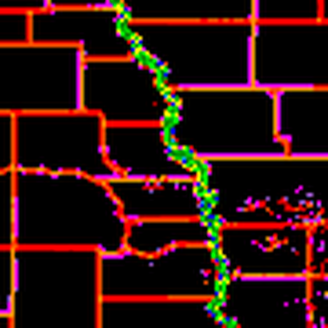
Today's worst verified hail core, straight off the NEXRAD archive. Read the annotations, then find the core yourself before revealing.
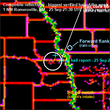
⚪ White ring - hail core
65+ dBZ: the storm's hail factory, where the updraft is strong enough to keep stones aloft growing.
65+ dBZ: the storm's hail factory, where the updraft is strong enough to keep stones aloft growing.
✛ Cyan cross - verified report
Ground truth: where 1.0-inch stones actually fell (2026-09-25 at 21:30 UTC).
Ground truth: where 1.0-inch stones actually fell (2026-09-25 at 21:30 UTC).
🌸 Yellow arc - inflow notch
The storm's intake: warm air feeding in, carved where the echo bends inward on the storm's flank.
The storm's intake: warm air feeding in, carved where the echo bends inward on the storm's flank.
🔵 Blue ring - forward flank
The broad rain core downwind. Rain, not hail - a common trap when reading a storm.
The broad rain core downwind. Rain, not hail - a common trap when reading a storm.
Case: 1 NW Romeroville, NM - 1.0-inch hail reported 2026-09-25 at 21:30 UTC (Public, via IEM archive). Radar frame 2026-09-25 2140Z - CONUS composite reflectivity, cropped ~450 km around the storm, NWS dBZ color ramp. The lesson re-cases itself to the biggest hail report of the past 7 days whenever a new one lands.